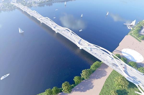
Ahead of Hanoi’s announcement of its master plan with a 100-year vision, the proposed development direction for the central urban area along Red River’s right bank has attracted considerable public and investor interest. Under the newly approved plan, the area will preserve the capital’s core historical and cultural values while developing new urban spaces over decades to come.
On June 29, Hanoi will host its 2026 investment promotion conference alongside the official announcement of the master plan. The event is regarded as a significant milestone in implementing the capital’s long-term development strategy following approval of the plan by the Chairman of the municipal People’s Committee on May 13.
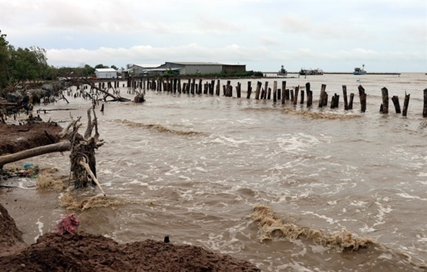
One of the most closely watched elements is the development orientation for the Red River right bank central urban area, identified as Hanoi’s political, administrative, financial, cultural and sports urban core. Located south of the Red River and extending from the historic inner city to newly developing areas in the south and the west, it covers approximately 45,317 hectares and is projected to accommodate around 6.365 million residents by 2045 and 6.455 million by 2065.
Preserving historical, cultural values as growth foundation
In the Ba Dinh – Thang Long Imperial Citadel area, the plan maintains its role as the national political and administrative centre while preserving heritage assets, landscapes, green spaces and historically significant structures. The area is intended to connect with West Lake, the Temple of Literature–Hanoi Station zone, and the Old Quarter to form an integrated cultural network.
For the Old Quarter, the focus remains on preserving the traditional urban fabric, craft streets, historical and religious sites, and cultural spaces closely linked to the formation of Thang Long–Hanoi.
Around Hoan Kiem Lake and surrounding areas, the city plans to conserve the distinctive landscape, restore historical buildings, expand public space and strengthen links with the Old Quarter, French Quarter, Thang Long Imperial Citadel and the Red River.
West Lake and its surrounding areas will continue to serve as a key centre for culture, tourism, services and landscape development. The plan envisages creating stronger spatial connections between West Lake, the Red River and Co Loa, while preserving historical and cultural sites and expanding public and pedestrian spaces along the lakeside.
")
Inner-city reconstruction and transit-oriented urban development
Alongside heritage preservation, the plan places strong emphasis on upgrading and regenerating existing urban areas. Within the historic inner city bounded by Ring Road 2, priorities include renovating ageing residential neighbourhoods and apartment blocks, repurposing obsolete industrial and warehouse sites, and expanding public amenities and green spaces.
Older residential complexes such as Thanh Cong, Giang Vo, Kim Lien, Trung Tu and Thanh Nhan are being studied for comprehensive redevelopment linked to mass public transport infrastructure.
The plan also prioritises the expansion of transit-oriented development (TOD) around urban railway stations and major transport hubs. Underground spaces, elevated developments and technical infrastructure will be integrated to improve land use efficiency and urban capacity.
For the expanded urban belt between Ring Road 2 and the Nhue River green corridor, Hanoi plans to develop new urban centres alongside modern service, commercial and public facilities. A new urban corridor with administrative, cultural, commercial and financial functions is planned along the West Lake–Co Loa axis.
Another notable proposal is the development of the West Lake–Ba Vi axis into a major cultural and landscape corridor connecting the city centre with its western area.
New urban zones and Olympic sports city
According to the plan, areas east and north of Ring Road 4 will see the development of new TOD-based urban zones integrated with public transport systems and major transport gateways, accompanied by new public, commercial and service centres.
Meanwhile, areas west and south of Ring Road 4 are designated for ecological and green urban development, combining service, commercial, scientific and technological functions. The plan also highlights the preservation and promotion of traditional craft villages such as Van Phuc, Da Si, Van Khe and Duong Noi as part of urban and cultural tourism development.
A major highlight of the Red River right bank central urban area is the proposed Olympic sports city at Hanoi’s southern gateway. The development is planned as a large-scale sports complex centred on a main stadium with a capacity of around 135,000 seats and a synchronous network of sporting facilities.
The Olympic sports city will be linked to the Ngoc Hoi TOD complex, the North–South high-speed railway, the national railway system and Hanoi’s urban rail network. According to the master plan, the area will offer rapid public transport access to the city centre, helping ease pressure on the existing urban core./.