A cultural heritage
Every square meter on Ly Son island in the central province of Quang Ngai is imbued with the culture of its ancestors who protected the sea hundreds of years ago.
According to royal decrees and family annals kept on Ly Son island by the Vo, Nguyen and Ly families, the Hoang Sa Flotilla was set up in the early 17th century by the Nguyen Lords in the south. According to official historical records, the Hoang Sa Flotilla was established before 1631 under the reign of Lord Nguyen Phuc Nguyen (whose reign lasted from 1613 to 1635). The fleet was tasked to mine marine resources, survey sea routes, plant milestones and erect steles affirming the national territory on Hoang Sa and Truong Sa archipelagoes.
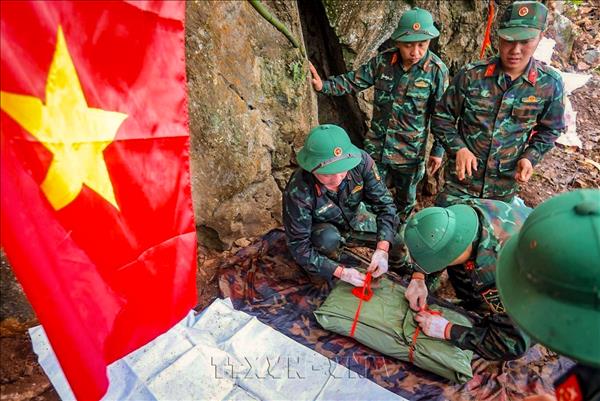
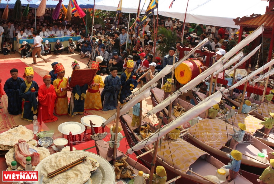 Le khao le the linh Hoang Sa is held by the Vo, Pham and Ly families on Ly Son island. Photo: Cong Dat 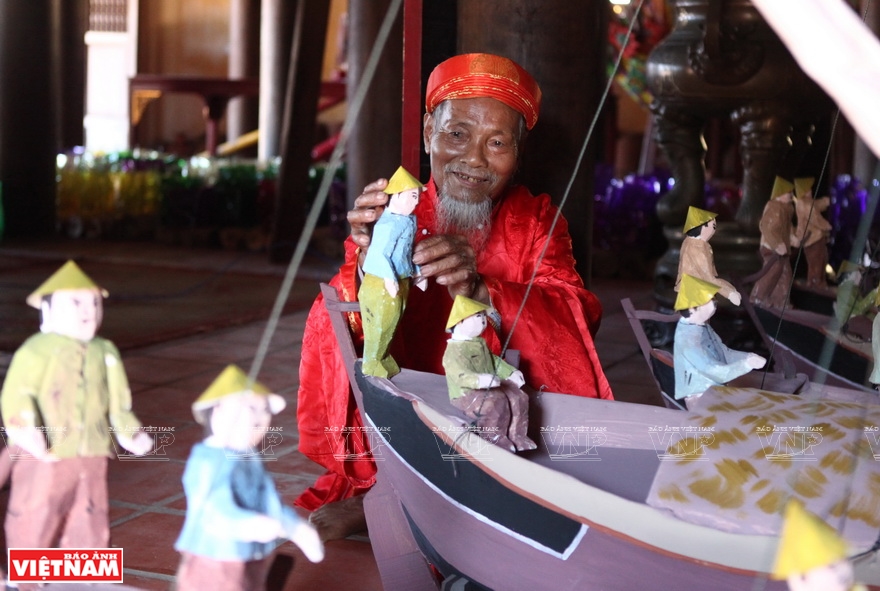 Vo Hien Dat prepares the dummies used in Le khao le the linh Hoang Sa. Photo: Cong Dat 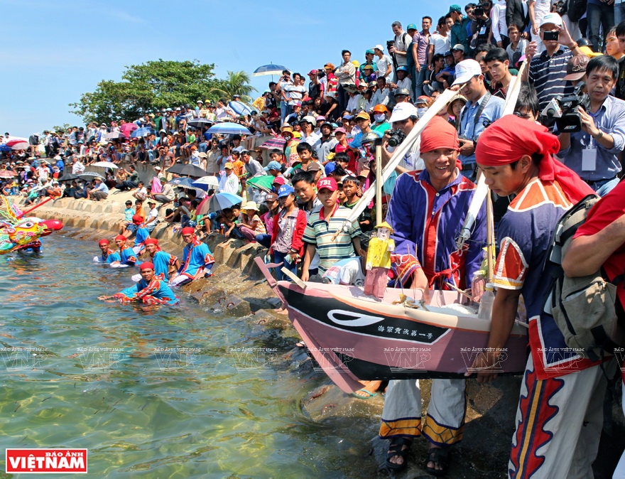 Releasing boat, a ritual at Le khao le the linh Hoang Sa. Photo: Cong Dat |
| Ly Son is where the cultures of the Champa, Sa Huynh and Dai Viet meet. The island has four national cultural relics and 14 provincial cultural relics. It also has various intangible cultural heritages, including Le khao le the linh Hoang Sa, recognized as a national intangible cultural heritage. |
Le khao le the linh Hoang Sa held in the second lunar month every year, has gradually become a tradition of Ly Son people to honor the brave soldiers who risked their lives to protect the sea and islands of the fatherland.
Ly Son island covers an area of less than 10 sq.km, but it has nearly 100 relics, most of which are related to the Hoang Sa Flotilla. They include Am Linh temple, the empty graves built for those Hoang Sa soldiers who never returned, the communal houses of An Vinh and An Hai Villages, the chambers worshipping Pham Quang Anh and Vo Van Khiet who were captains of the Hoang Sa Flotilla.
A unique wonder of nature
The geography and terrain of Ly Son were shaped after volcanic eruptions about 10,000 years ago, according to Dr. Pham Thi Ninh of the Vietnam Archaeology Association.
The geological tectonics created original landscapes on Ly Son which are rare anywhere else in the world. Among the beautiful sites are Cau cave, To Vo Arch, and Gieng Tien and Thoi Loi craters, which have high scientific and tourist value.
| An international conference discussing the heritage value of Ly Son-Sa Huynh geopark was held in Quang Ngai on June 18-19. The conference, which was attended by 550 foreign and local experts, scientists, and researchers, sought to conserve the heritage and develop sustainable tourism. |
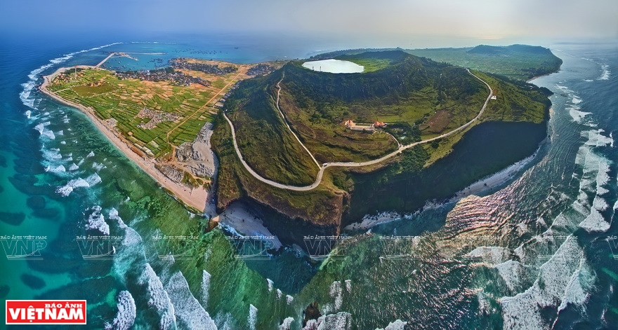 Panoramic view of Ly Son. Photo: Minh Tan 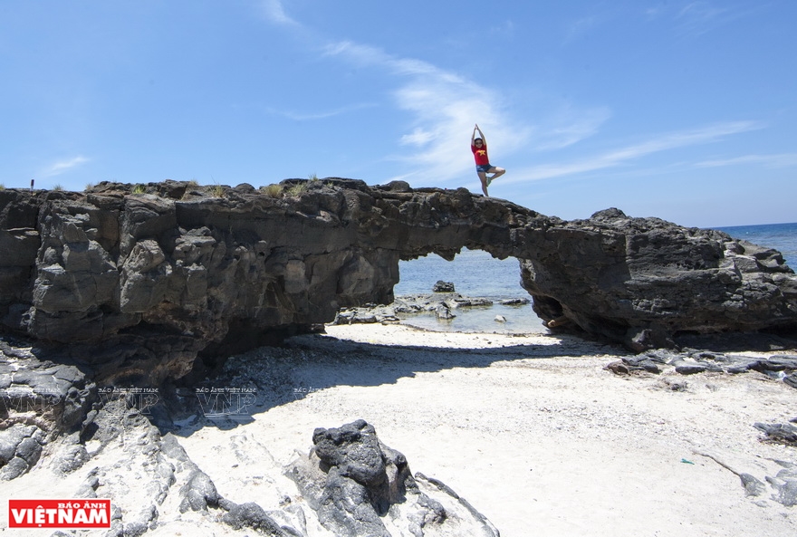 To Vo Arch is a 2.5m high rock gate formed by geological tectonics. It is an ideal venue to see sunset and take photos. Photo: Trong Chinh 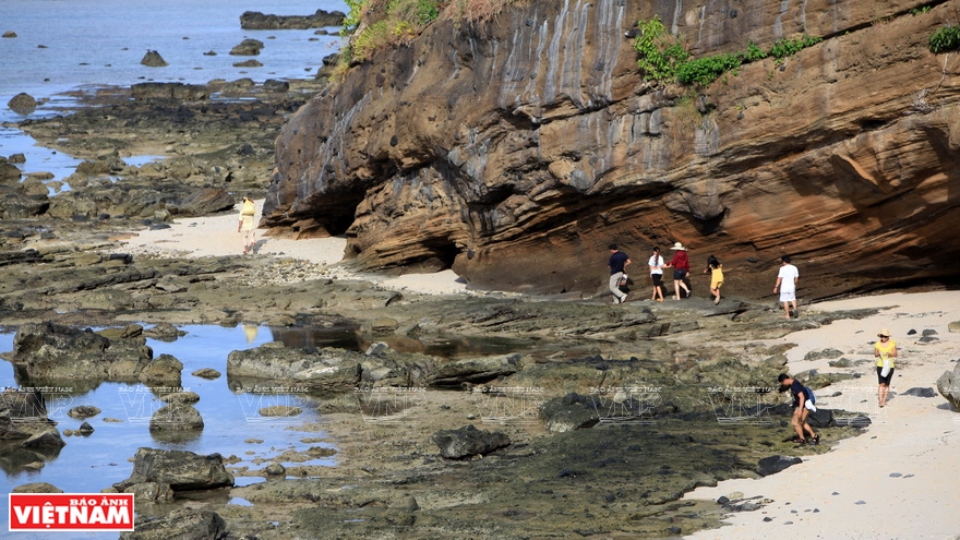 Gorgeous sedimental cliffs on the way to Hang (Cave) pagoda. Photo: Phong Thu 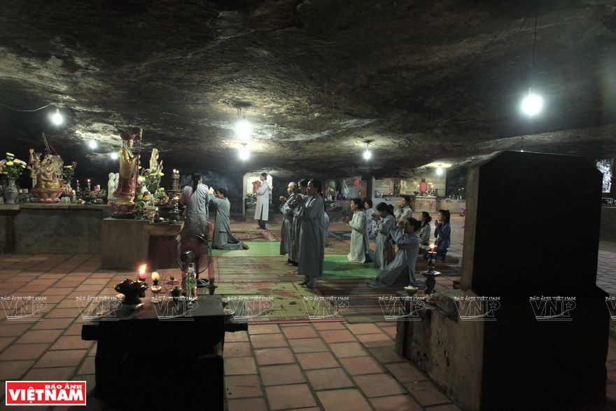 Volcanic tectonics created sedimental caves on Ly Son, one of which was Hang pagoda. The cave was discovered by the Cham about 400 years ago. Photo: Phong Thu 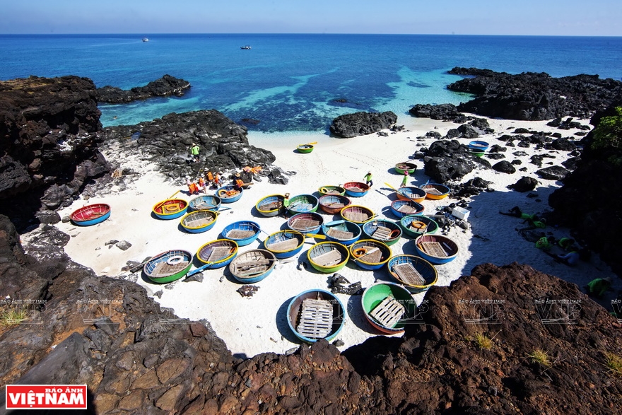 The white sandy beach on Dao Be (small island) lies by the side of arch cliffs shaped by volcanic sediments. Photo: Trong Chinh 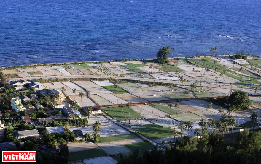 Onion and garlic fields on Ly Son island. Volcanic eruptions formed a layer of basalt soil on the surface of the island, which is particularly suitable for growing garlic. Photo: Trong Chinh 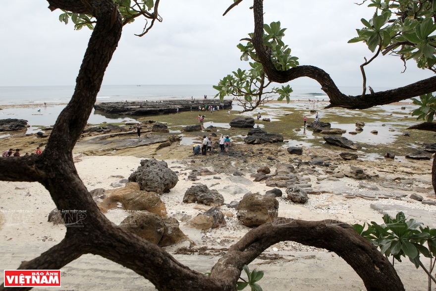 Sedimental ground on Ly Son. Photo: Phong Thu 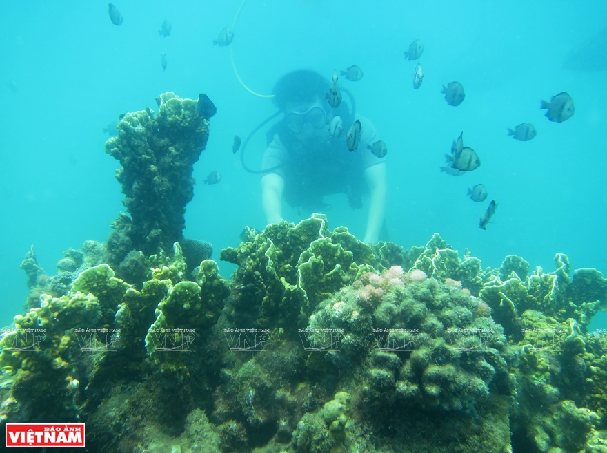 Diving to explore coral. Photo: Anh Quan 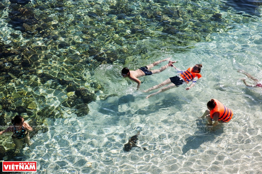 Swimming in the clear blue water of Dao Be. Photo: Trong Chinh |
|
“Ly Son-Sa Huynh geopark concentrates all the geological, historical, cultural and archeological values of a heritage. It has the prospect to be recognized as a global geopark by UNESCO.” Guy Martini, Chairman of the UNESCO Global Geoparks Council and General Secretary of the Global Geoparks Network. |
In 2015, Quang Ngai province established Ly Son-Sa Huynh geopark to conserve the rich biodiversity and geological, cultural and historical values of the island. The park covers Ly Son island and adjacent coastal areas in Binh Chau and Binh Hai communes, Binh Son district, with Ly Son as the core. Quang Ngai province is finalizing dossiers to propose the recognition of Ly Son as a UNESCO geopark. The dossiers are expected to be submitted to UNESCO this November.
| Ly Son’s biodiversity includes many species named on the Vietnamese and IUCN Red Lists of Threatened Species. Ly Son sea has more than 700 marine species, including 200 types of fish, 157 types of coral, 137 types of seaweed, 96 types of crustaceans, and 70 types of mollusks. |
Story: Phong Thu
Photos: Trong Chinh, Viet Cuong, Cong Dat, Minh Tan & Phong Thu
Photos: Trong Chinh, Viet Cuong, Cong Dat, Minh Tan & Phong Thu