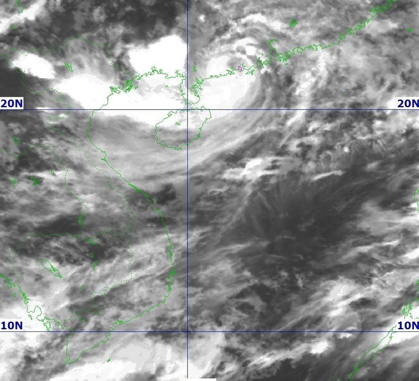
At 4am on July 21, Typhoon Wipha was at around 21.5 degrees North and 110.4 degrees East, on China’s Leizhou Peninsula. (Source: National Centre for Hydro-Meteorological Forecasting)
Typhoon Wipha is approaching northern Vietnam as it hit China’s Leizhou Peninsula and was about 275km to the east of the Quang Ninh – Hai Phong coast at 4am on July 21.
At 4am on July 21, the storm, the third to appear in the East Sea this year, was at around 21.5 degrees North and 110.4 degrees East, sustaining maximum wind speeds of Level 9, gusting up to Level 11. It was moving west – southwest at 15–20km per hour, according to the National Centre for Hydro-Meteorological Forecasting.
By 4am on July 22, it is predicted to maintain the direction, move at a speed of some 15km per hour, and intensify. Wind speeds may reach Level 10–11, with gusts of Level 14. Impacted areas include the northwestern part of the East Sea’s northern waters, the north of the Gulf of Tonkin, and inshore areas from Quang Ninh to Hung Yen provinces.
By 4am on July 23, Wipha is forecast to keep moving west – southwest at 10–15km per hour and abate into a tropical depression in mainland areas of the provinces from Hung Yen to Thanh Hoa. Wind speeds at that time will stand at Level 6–7, gusting to Level 9. Affected areas include the Gulf of Tonkin and inshore areas from Quang Ninh to Nghe An.
In the following 24 hours, it will maintain the path and weaken into a low-pressure area in northern Laos.
From July 21 evening, winds will gradually strengthen in coastal areas from Quang Ninh to Nghe An, said the forecasting centre.
From July 21 to July 22 night, the northeastern region, the Red River Delta, and the north-central provinces of Thanh Hoa and Nghe An are expected to record heavy rains and gales, with rainfall of 170–280mm, even over 450mm in certain places. Downpours are also predicted for other areas in the North and central Ha Tinh province, reaching 80–160mm, even over 250mm.
The entre also warned risks of flash floods and landslides in those provinces, along with certain places in the northern mountainous provinces of Dien Bien and Son La and the central province of Quang Tri./.


