Islands of A Dragon Legend & Prosperity

Driven by a dream of controlling the seas, the ancient Vietnamese wove tales of dragons into the very fabric of their coastal heritage, particularly in the Gulf of Tonkin. They include Hai Phong City, home to Bach Long Vi Island district, meaning "White dragon's Tail”, Bai Tu Long Bay, meaning "Bay of Baby dragons” and Cai Rong Port, meaning “Mother dragon” in Van don Island district, Quang Ninh Province and dragon Claw Rock in Co To Island district. Today, these three island districts stand as beacons of maritime economic development in northern Vietnam.

Bearing the ancient name of Chang Son (Mountain of the Young Man), Co To Island has long been a haven for boats and fishermen from the northeastern sea region. In 1832, Nguyen Cong Tru, the Governor-General of Hai An, petitioned the court to establish villages and communes, appointing officials to manage and defend against seaborne threats. Following the restoration of peace in the North (1954), the Party and State established a district-level administrative unit on Co To Island.


Situated in the northeast of Quang Ninh Province, Co To Island District covers a natural area of over 47km2 and has a population of about 6,700 people. It comprises over 30 large and small islands, including the three largest; Co To, Thanh Lan, and Tran Island (also known as Chan Island or Chang Tay Island). Co To Island borders the international maritime border to the east, stretching nearly 200km from the coast of Tran Island to Bach Long Vi Island District. It is one of the outposts of great political, economic, defense, security, and foreign affairs significance in the northeastern waters of the country.
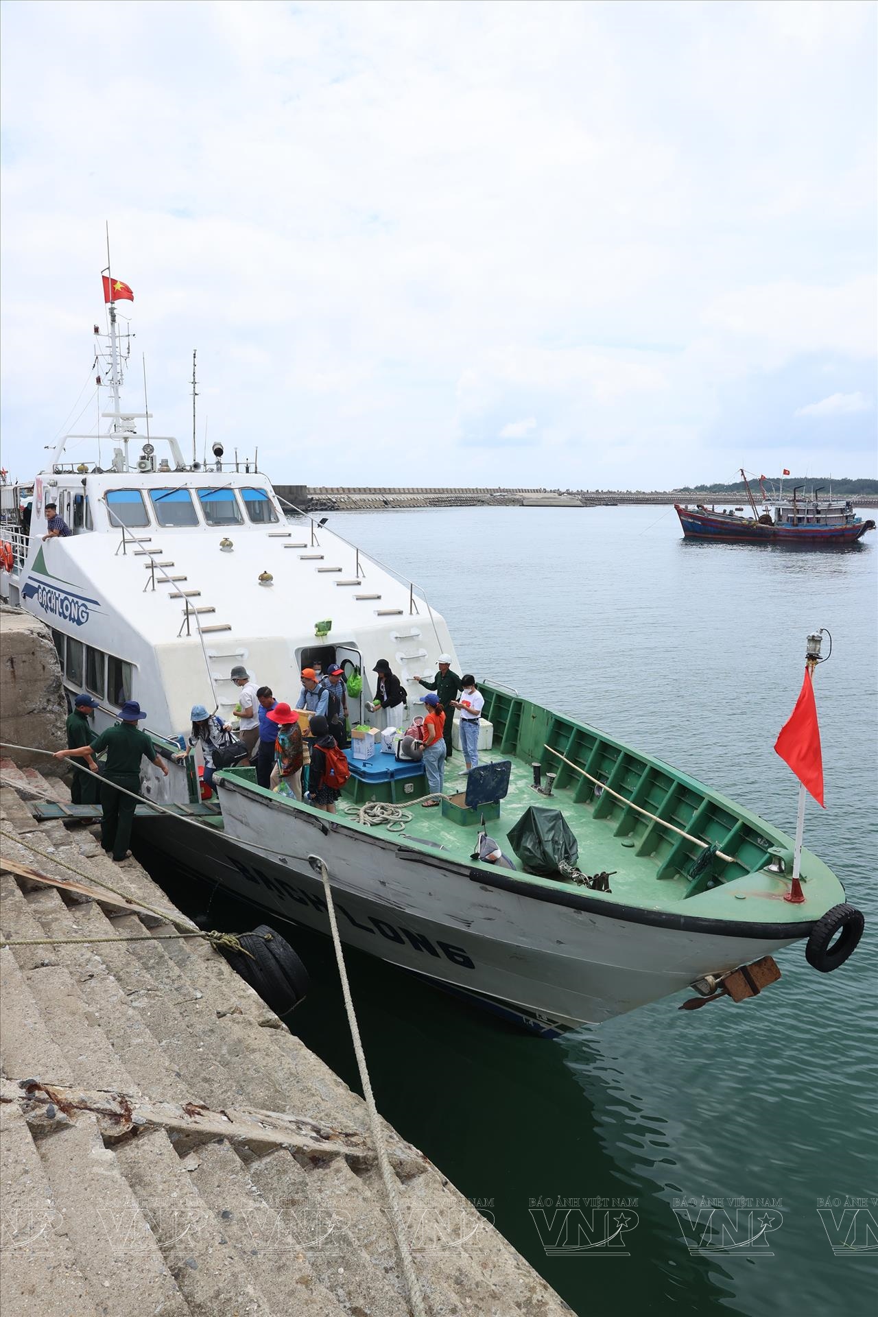
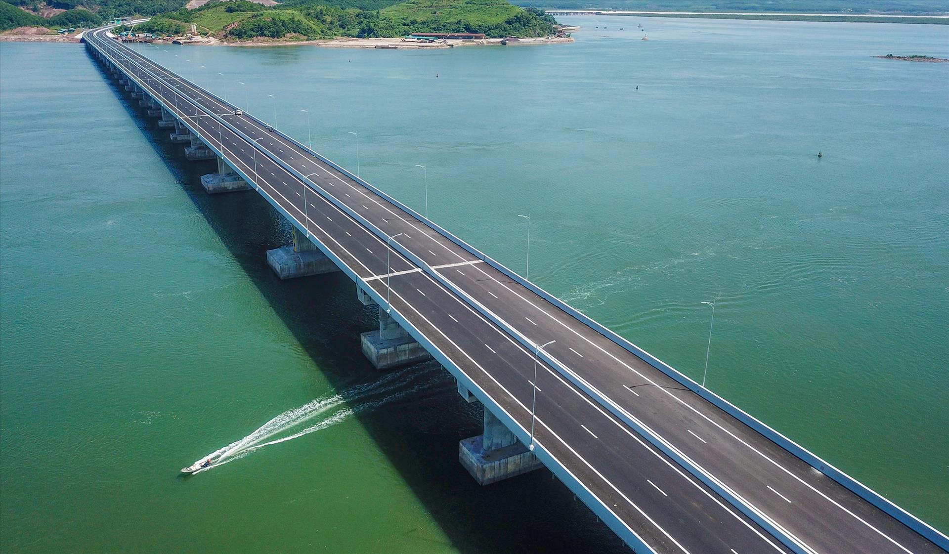
The electrification of Co To Island in 2013, coupled with the investment in waterway infrastructure projects, has significantly reduced travel time from the mainland to the island. The development of a waterway infrastructure alongside the national power grid has transformed Co To's fishing logistics service center into a strong foothold, enabling fishermen in the island district to venture further offshore for extended periods.
Once a remote island, Co To now boasts over 30 highspeed ferries connecting it to the ports of Ao Tien, Cai Rong (Van Don), Tuan Chau (Hạ Long), and Vung Duc (Cam Pha). In July 2023, a commercial seaplane route linking Tuan Chau Island (Ha Long City) to Co To was officially launched, carrying tourists in under 20 minutes of flight. This has laid the groundwork for Co To to become part of a "dynamic zone" in accordance with Quang Ninh Province's development spatial planning orientation.
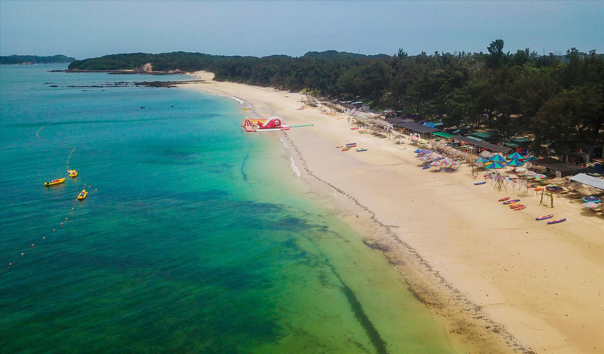
Co To boasts an abundance of stunning beaches, such as Mong Rong, Hong Van, Van Chay, Bac Van, Tinh Yeu, Vom Si, and Vung Ong Vien, scattered throughout the island. Some beaches stretch for many kilometers with fine, white sand, while others are nestled amidst rocky cliffs and fringed by rows of verdant casuarinas. Co To’s waters are considered one of Vietnam's top biodiversity hotspots, harboring diverse ecosystems typical of tropical marine environments, including a rich coral reef system.
The area also boasts a remarkable variety of seafood, including many rare and valuable species. In recent years, Co To’s tourism and service industries have witnessed remarkable growth, becoming the island district's spearhead economic sector, accounting for nearly 70% of its economic structure. Each year, Co To welcomes over 300,000 domestic and international tourists.
Bach Long Vi - Center for Fisheries Logistics

Legend has it that during the reign of the Hung Kings, the East Sea of the ancient Vietnamese, known as the Lac Viet, was rich in natural resources with deep bays teeming with pearls and vast coves brimming with sea cucumbers, abalone, shrimp, and fish. Enticed by this wealth, marauding pirates descended upon the region, seeking to plunder its treasures. Upon witnessing the plight of the Lac Viet, the Jade Emperor dispatched Mother Dragon and her brood to help the Vietnamese people. After vanquishing the pirates, Mother Dragon, captivated by the breathtaking beauty of the sea in the North, chose to remain, becoming the guardian of the Lac Viet. In honor of this legendary tale, the people bestowed upon an island off the coast of the Gulf of Tonkin the name Bach Long Vi, meaning "White Dragon's Tail".
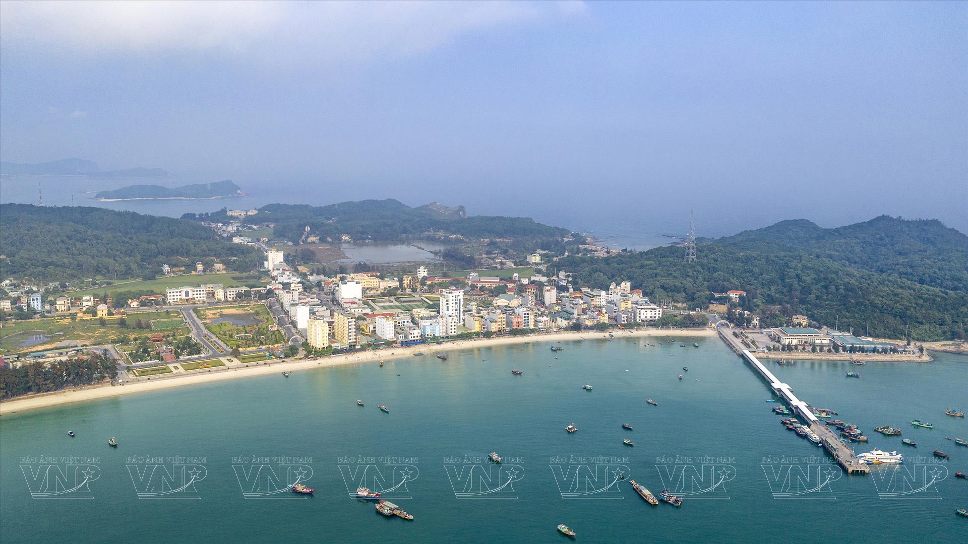
Nowadays, Bach Long Vi is an island district located in the Gulf of Tonkin, about 110km from Hai Phong City. Despite its relatively small area of 2.33km2, Bach Long Vi Island holds a strategic position and special importance in terms of national defense-security and maritime economic development.
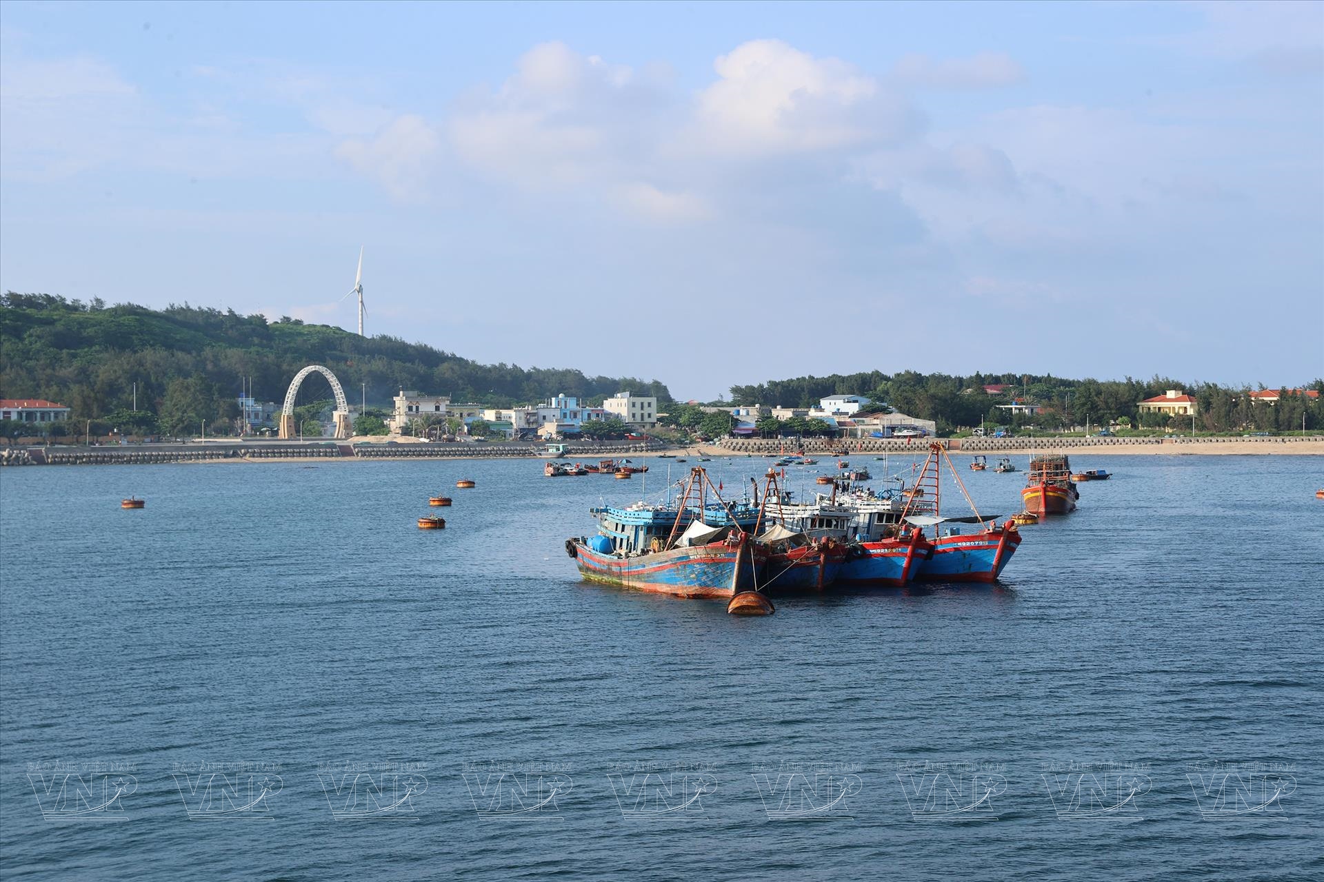
Bach Long Vi maritime area is one of the eight major fishing grounds in the Gulf of Tonkin, with an area of 1,500 square nautical miles, an average depth of 35-55m (the deepest point is 60-70m), and a relatively flat seabed, making it favorable for the development of offshore fishing. There are nearly 400 species of sea creatures in the Bach Long Vi maritime area, including many species with high economic value such as grouper, coral trout, sea cucumber, sea grapes, sea lettuce, seaweed, and seaweed fans. This place is considered the "capital" of abalone, which has high nutritional and economic value.


As a major fishing ground, Bach Long Vi Island District has been invested in and developed into a logistics center for fishing and search and rescue in the North. The port system in Bach Long Vi can accommodate nearly 2,000 boats and ships needing shelter from storms, buying and selling seafood, supplying food, fuel, and freshwater. This is a familiar destination for thousands of fishing boats from all over the country.
Bach Long Vi Island captivates visitors with its unique natural beauty. Here, the Gulf of Tonkin boasts a developed coral reef ecosystem, with some areas reaching an impressive 90% coverage.
The island itself, along with its coastline, offers a blend of natural and man-made wonders. Lush greenery forms a vibrant island ecosystem, while coastal ecosystems add to the ecological diversity.
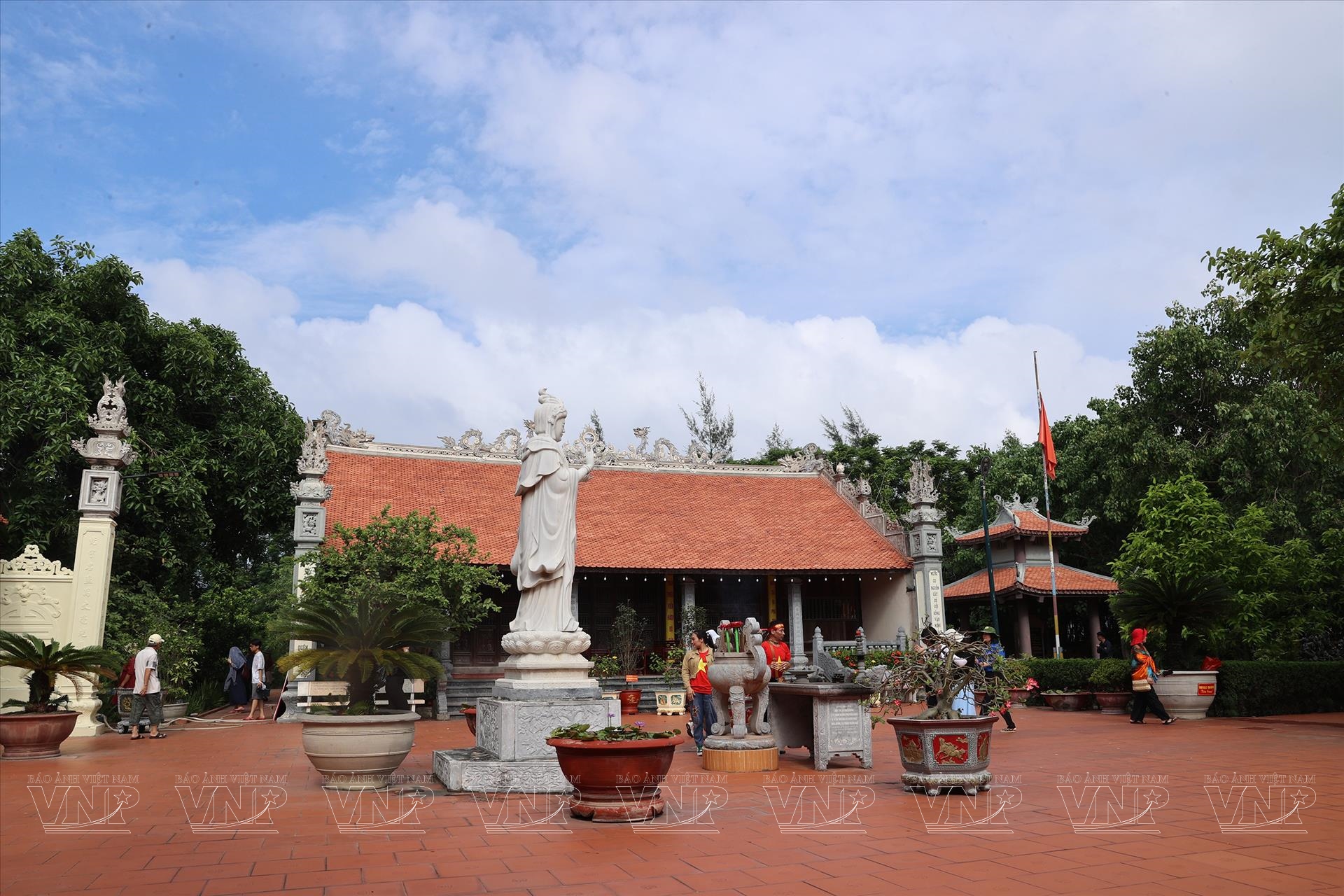
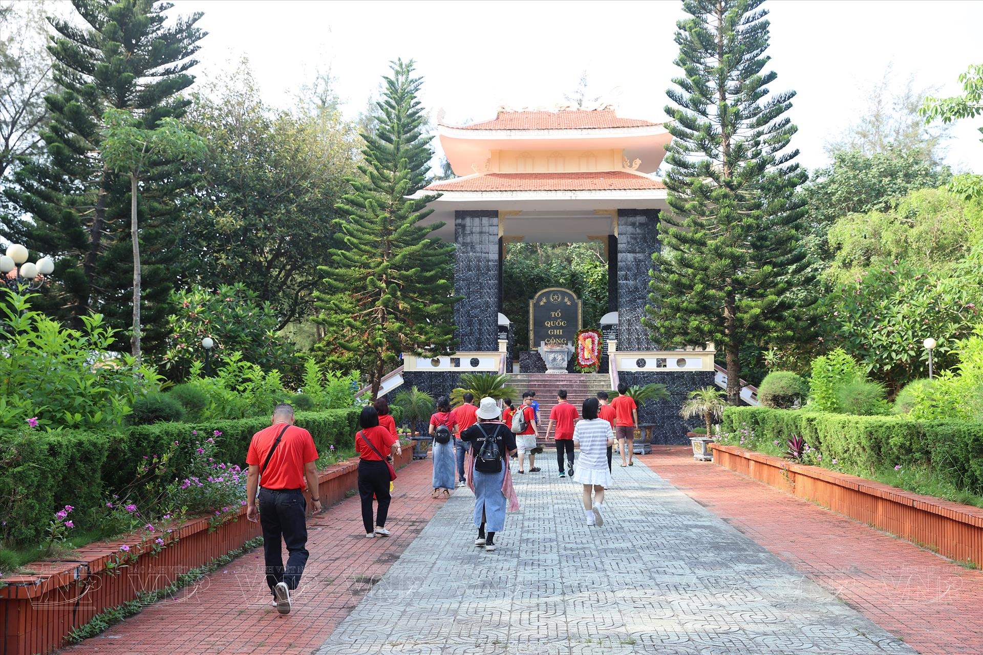
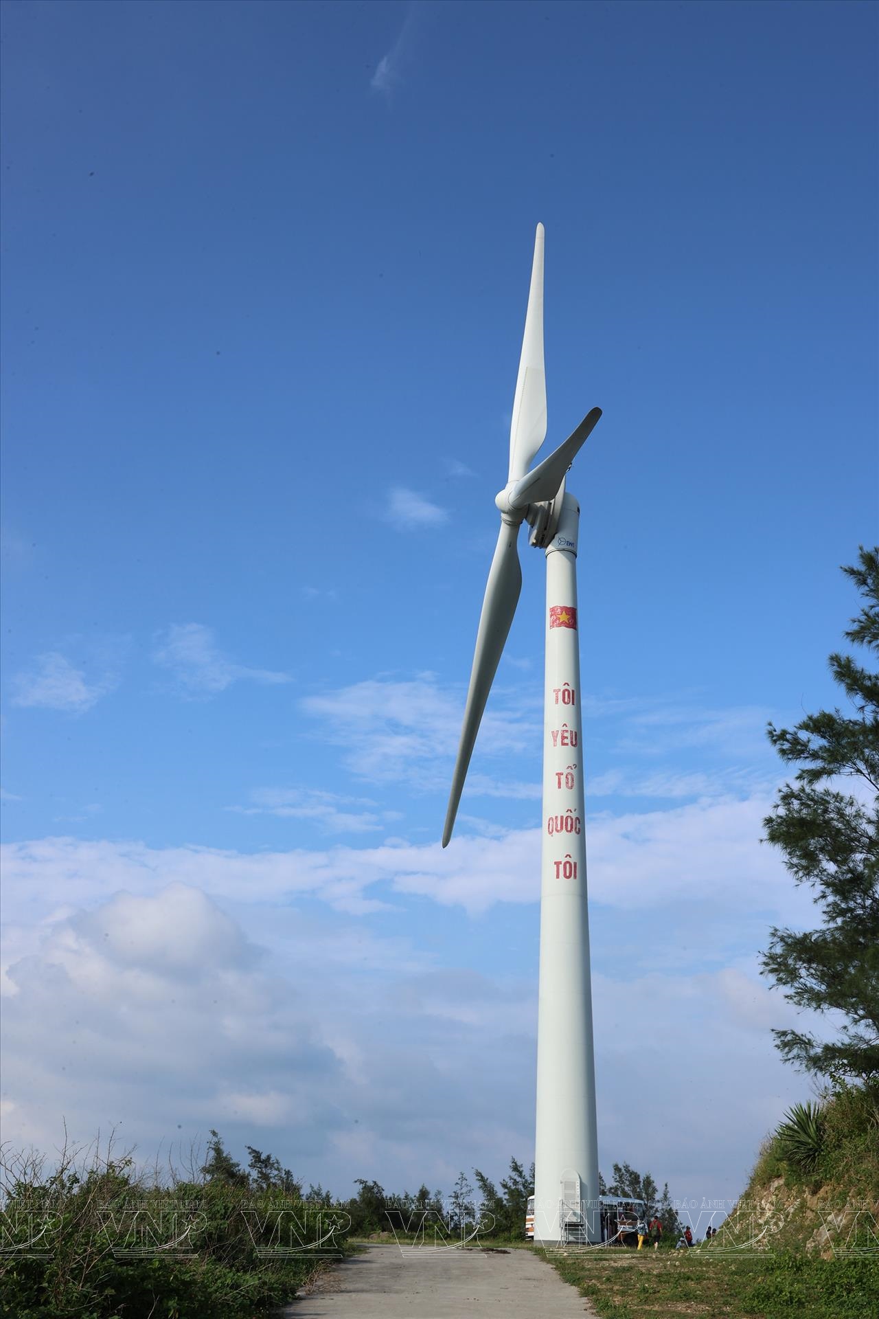
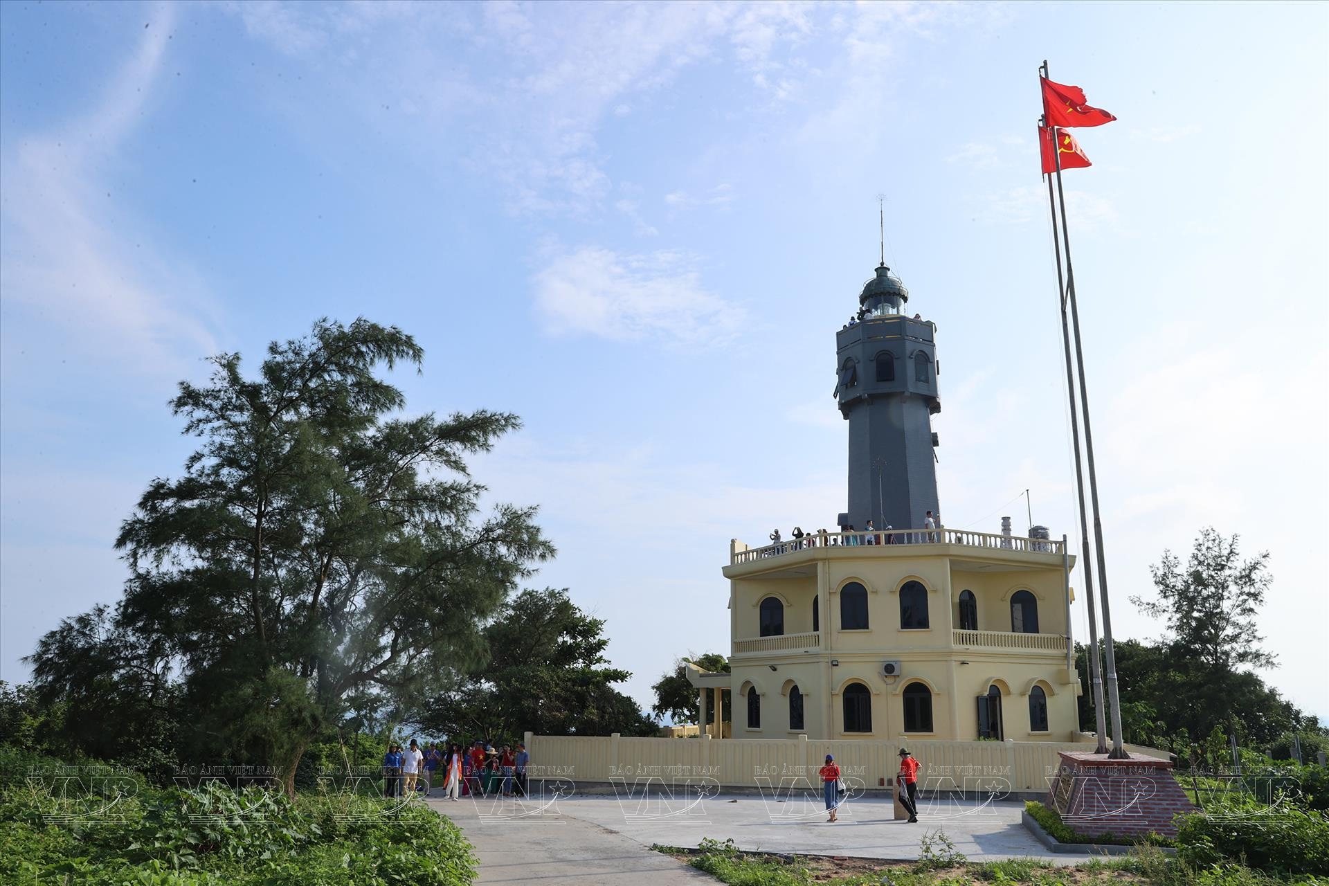
Lighthouses, wind turbines, meteorological stations, tide gauges, and ports stand as testaments to human ingenuity, seamlessly integrated with green parks, abalone farms, and cultural treasures like museums, memorials, Bach Long Pagoda, Tran Hung Dao Temple, and the Buddha Tower. This harmonious coexistence creates a truly remarkable tourism destination.
Van Don: Revival of An Ancient Trading Hub
Van Don, once a major trading port, was known as the starting point of the "Silk Road" of the sea and a place of commercial exchange with countries like Japan, China, India, Thailand, and Indonesia. This ancient port flourished during the three dynasties of Ly, Tran, and Post- Le before being forgotten during the Mac Dynasty. Today, Van Don Island District is comprised of 600 large and small islands, located mainly in Bai Tu Long and partly in Ha Long Bay, giving it many advantages in terms of sea, air, and road transportation. Notably, Van Don is the intersection of economic corridors of the Vietnam-China Economic Belt, the Nanning-Singapore Economic Corridor, and the Northern Key Economic Zone (Hanoi-Hai Phong-Quang Ninh). These are the outstanding and distinctive advantages of this island district.
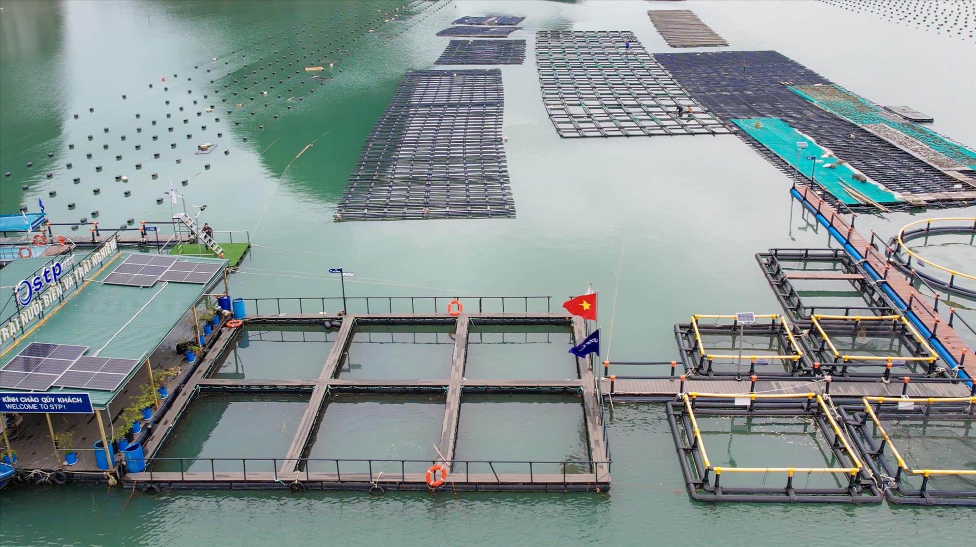

Van Don boasts a thriving aquaculture industry, capitalizing on its favorable natural conditions. With a total aquaculture area of 7,444ha, Van Don is home to 1,156ha dedicated to fish farming and 6,288ha for mollusk cultivation. Based on elements such as a water source, depth, currents, and plankton distribution, Van Don’s marine aquaculture area has been divided into 71 designated zones which have 62 aquaculture facilities assigned with unique traceability codes, enabling consumers to track the origin of their seafood products.
Van Don boasts Bai Tu Long Bay which is nestled adjacent to the worldrenowned Ha Long Bay. It unveils a captivating tapestry of rocky islands, inhabited islets, and pristine beaches. Gently sloping white sand beaches, sheltered from wind and waves, are embraced by the verdant embrace of Bai Tu Long National Park, a "hidden gem" of Vietnam's ecosystem.
The grand opening of Ao Tien, a state-of-the-art deep-water port, has heralded a remarkable transformation for this "Land of Dragons” which has a cutting-edge multimodal transportation network, encompassing an airport, expressway, and modern passenger port, positioning it as a premier island district in Vietnam.
This remarkable infrastructure, coupled with Van Don's diverse pristine scenery and ecosystems, has not only revitalized the region's appearance but also unlocked the untapped potential of Bai Tu Long Bay.


Story: Thong Thien Photos: Hoang Ha, Truong Giang & Cong Dat/VNP
Translated by Hong Hanh
- Designed by Trang Nhung