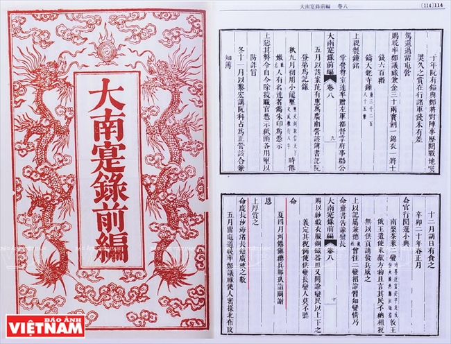
“Dai Nam Thuc luc tien bien” (The First Part of The Chronicles of Dai Nam), a historical document collection
completed by Quoc Su Quan in the 4th year of Emperor Thieu Tri (1844) according to Emperor Minh Mang’s order,
states that Mac Cuu, the military leader of Ha Tien, was generously awarded by Lord Nguyen Phuc Chu
for conducting the measuring of Truong Sa Shoal.
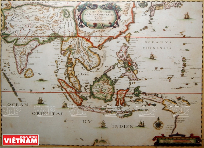
Map “Carte generale des Indes orientales et des Islles Adiacentes” made by Mariette
in 1790 shows that the Paracel Islands belong to Vietnam.
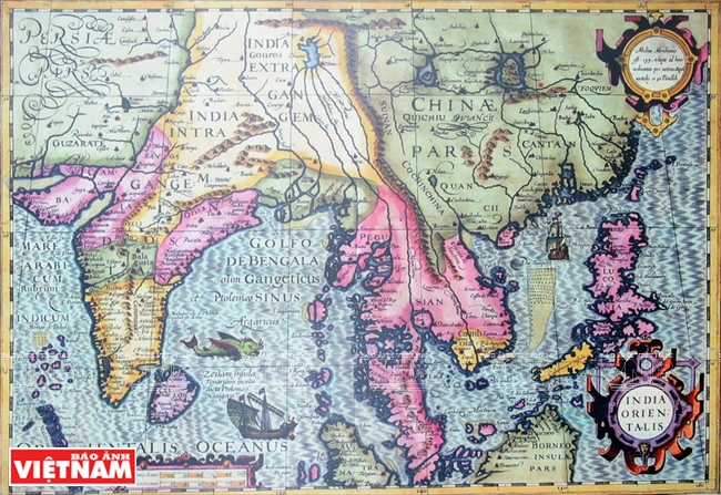
In the map “India Orientalis” made by Jodocus Hondius in 1613, Paracel and Spratly Islands are presented as connected
and given the common name of Peacel.
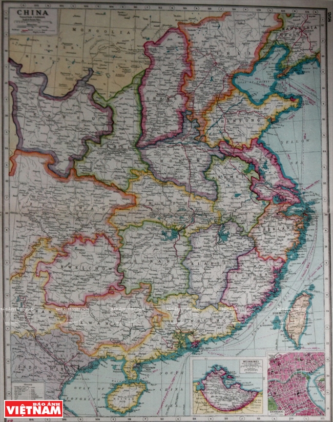
A map of China published by the Atlas of the World in London (the UK) in 1914
shows that the southernmost point of China is Hainan Island.
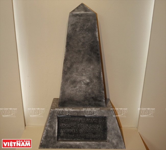
The inscription on the stele placed by the Vietnamese in June, 1938 reads: “The French Republic, The Kingdom of An Nam,
The Paracel Islands, 1816 – Pattle Island – 1938”. Photo taken in 1938.
Photos were taken by Tran Thanh Giang/VNP at the exhibition titled “Hoang Sa, Truong Sa - Historical Evidence”
held at the Vietnam Military History Museum in 2014.
|