Millions of years of volcanic eruptions and the special tectonics of the earth’s crust have created a pristine and mysterious Dak Nong global geopark boasting spectacular waterfalls and caves and wild lava fields.
Krong No, a kingdom of lava caves
Krong No is a northeastern district around 100km from Gia Nghia, Dak Nong’s capital. The district is the core area of Dak Nong global geopark and regarded as a volcano kingdom with some 50 volcanic caves which cannot be seen anywhere else in the world.
Dak Nong’s geological history dated from the Jurassic period some 200 million years ago. Dak Nong used to be part of the seabed until the Paleogene period (around 60 million years ago) when the seawater receded and volcanoes appeared, causing basalt eruptions which only ended about 10,000 years ago.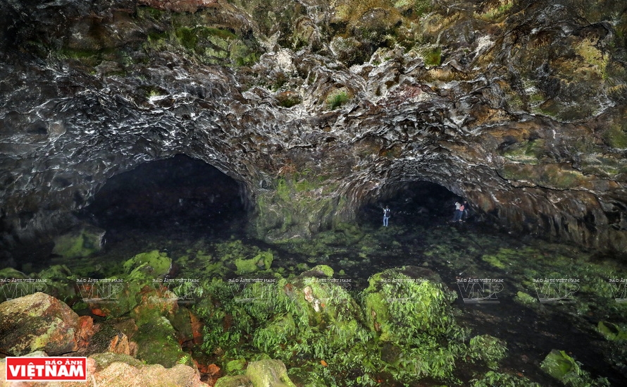
The beauty inside cave C9 seen through the light shining from the mouth of the cave. Photo: Cong Dat
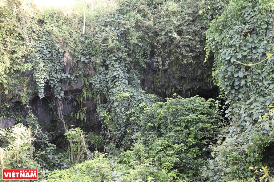 Volcanic cave C8 in the neighborhood of Chu B’luk volcano. Photo: Cong Dat Volcanic cave C8 in the neighborhood of Chu B’luk volcano. Photo: Cong Dat |
Strong eruptions of Chu B’luk volcano in present day Buon Choa’h commune, Krong No district, were believed to create a unique system of volcanic caves. In the neighborhood of Chu B’luk volcano, volcanic caves with original structures were found, including C7, C9, C6, and C6.1 caves. | Traces of human activities in the prehistoric ages dating back between 7,000 and 10,000 years ago were found at caves in Dak Nong geopark, which is rare for lava caves. |
From Dak Mam town, the center of Krong No district, we started our journey to explore Krong No “kingdom” of volcanic caves.
At C9, the cave nearest to Chu B’luk volcano, through the light shining from the mouth of the cave, we were stunned by a spectacular scene which was just like that in Jurassic Park. Basalt lava masses in various colors and shapes and a green forest of lichen, ferns and many types of herbaceous plants turned out a mysterious scene that brought one back to the beginning of life on earth. Going deeper, using a flashlight there appeared reddish brown basalt cliffs formed by million-year-old lava flows. On the ground of the cave were layers of volcanic ash and cinders weathered through times.
According to Nguyen Van Thuan, former director of the General Department of Geology and Minerals of Vietnam, the system of lava caves in Krong No is larger and much more interesting than the Manjanggul Lava Tube on Jeju island, a tourist site in South Korea. Epic of rocks and water Through millions of years, geographic tectonics forming fault zones and volcanic eruptions transformed Dak Nong terrains, resulting in changes in the flows of the Serepok and Dong Nai rivers. These have created gorgeous natural waterfalls such as Luu Ly, Truot, Bay Tang, Gia Long and Dray Sap.
Located in Gia Nghia, the 30m high Lieng Nung waterfall formed by the flow of Kak Nia stream which runs through N’Jrieng village shows the wild beauty of the mountains and forests. From the high mountain cliff, the waterfall looks like a girl with beautiful long hair flying freely in the jungle. At the foot of the waterfall is an arch hundreds of meters wide which was formed from hundreds of thousands of moss-covered basalt pillars layered in a beehive shape. 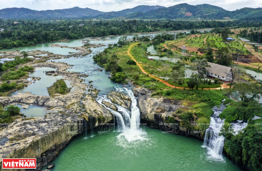
Dray Sap waterfall connects the two provinces of Dak Lak and Dak Nong. Photo: Cong Dat
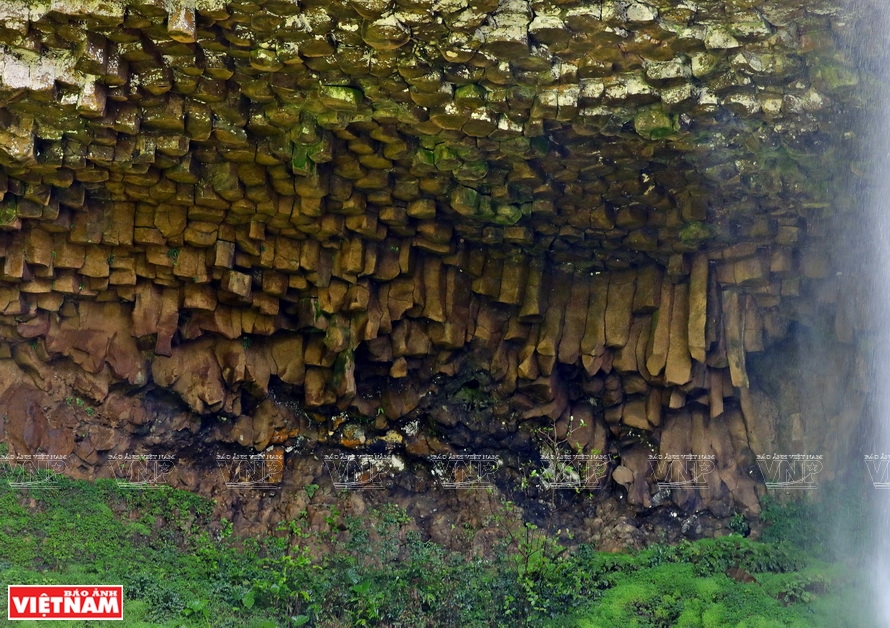 Beautiful geological formations on the cliffs of Gia Long waterfall in Dak So commune, Beautiful geological formations on the cliffs of Gia Long waterfall in Dak So commune,
Krong No district. Photo: Cong Dat 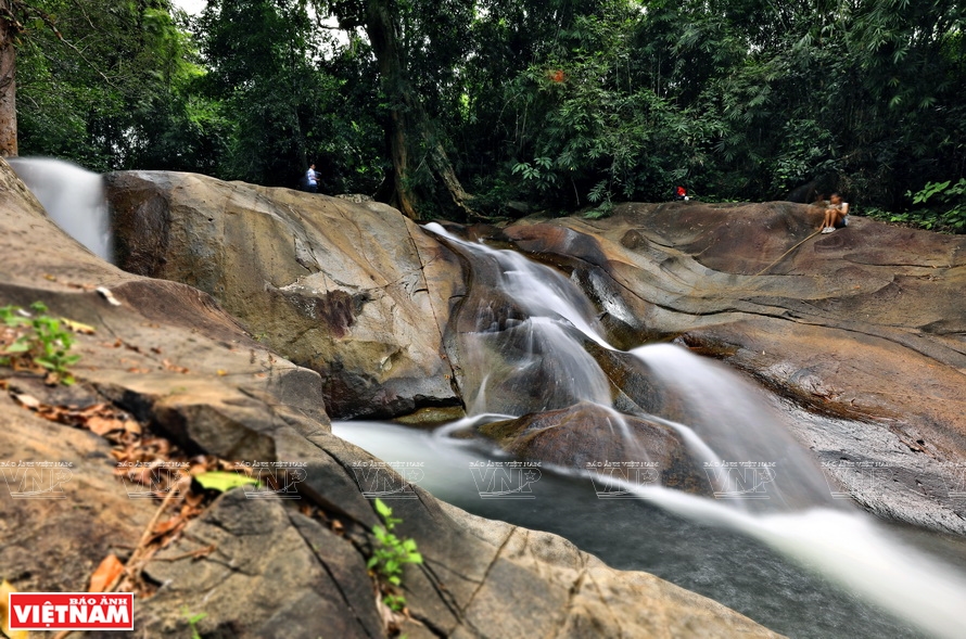 Granite waterfall, also known as Slide waterfall in Ta Dung national park. Granite waterfall, also known as Slide waterfall in Ta Dung national park. 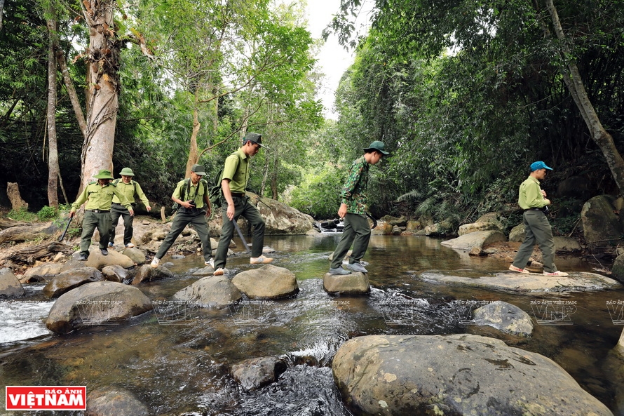 Forest rangers patrol Ta Dung national park. Photo: Cong Dat Forest rangers patrol Ta Dung national park. Photo: Cong Dat  Indigenous people living in the Dak Nong global geopark preserve the gong culture. Photo: Thanh Hoa Indigenous people living in the Dak Nong global geopark preserve the gong culture. Photo: Thanh Hoa 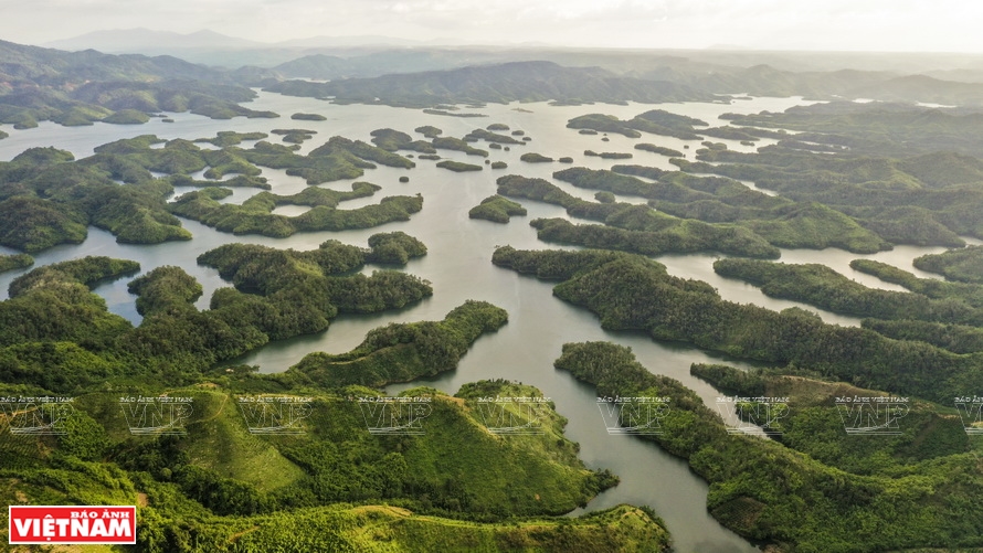 Ta Dung lake in Ta Dung nature reserve is an attractive tourist destination. Photo: Cong Dat Ta Dung lake in Ta Dung nature reserve is an attractive tourist destination. Photo: Cong Dat |
Krong No district is also home to Gia Long and Dray Sap waterfalls, the most popular scenery in the Central Highlands, where rocks, water and plants are intermingled harmoniously just like a wonderful “concert” of the forest. In the waterfall area are mountain cliffs and falls in numerous beautiful shapes formed by million-year-old lava flows. | On July 7, 2020, Dak Nong geopark was recognized by UNESCO as the third global geopark in Vietnam. The 4,760-km2 geopark covers the districts of Krong No, Cu Jut, Dak Mil, Dak Song, and Dak G’long, and Gia Nghia in Dak Nong province. |
Dak Nong global geopark is where indigenous ethnic groups, including the M’Nong, Ma and Ede, have lived for ages with a rich culture, and original and diverse traditions and customs. This ethnic community is home to such cultural heritages as the Central Highlands gong cultural space, an intangible unwritten cultural heritage of humanity, and the lithophone, an ancient musical instrument dating back about 2,500 years ago.
“As a UNESCO-recognized global geopark, Dak Nong is now not only a local and national heritage but that of humanity and thus should be made known to the world,” said Ton Thi Ngoc Hanh, Vice Chairwoman of Dak Nong People’s Committee. “To attract investors and visitors to Dak Nong, the province will promote tourism, including participation in national and international tourism events,” Hanh said. Story: Thanh Hoa, Hong Hanh Photos: Cong Dat, Thanh Hoa